software-plava.jpg
Astel Projekt

Astel Software

ASTEL
SOFTWARE

ASTEL PROJEKT has designed and developed its own custom-made software for the prediction of signal coverage strength and calculation of radio relay signal. This software, called ASTEL SOFTWARE, has been registered with the Intellectual Property Office (registration number A-0067/2015).

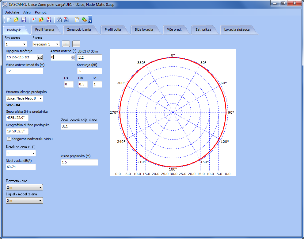
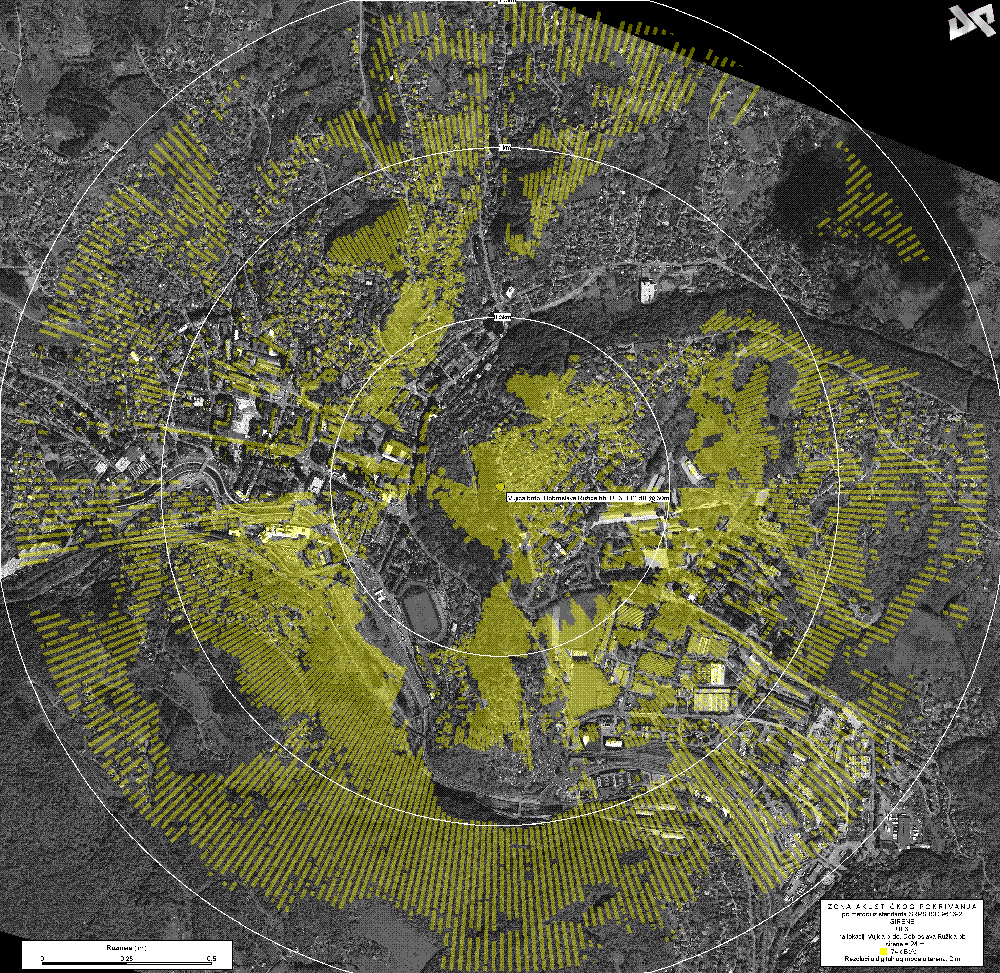
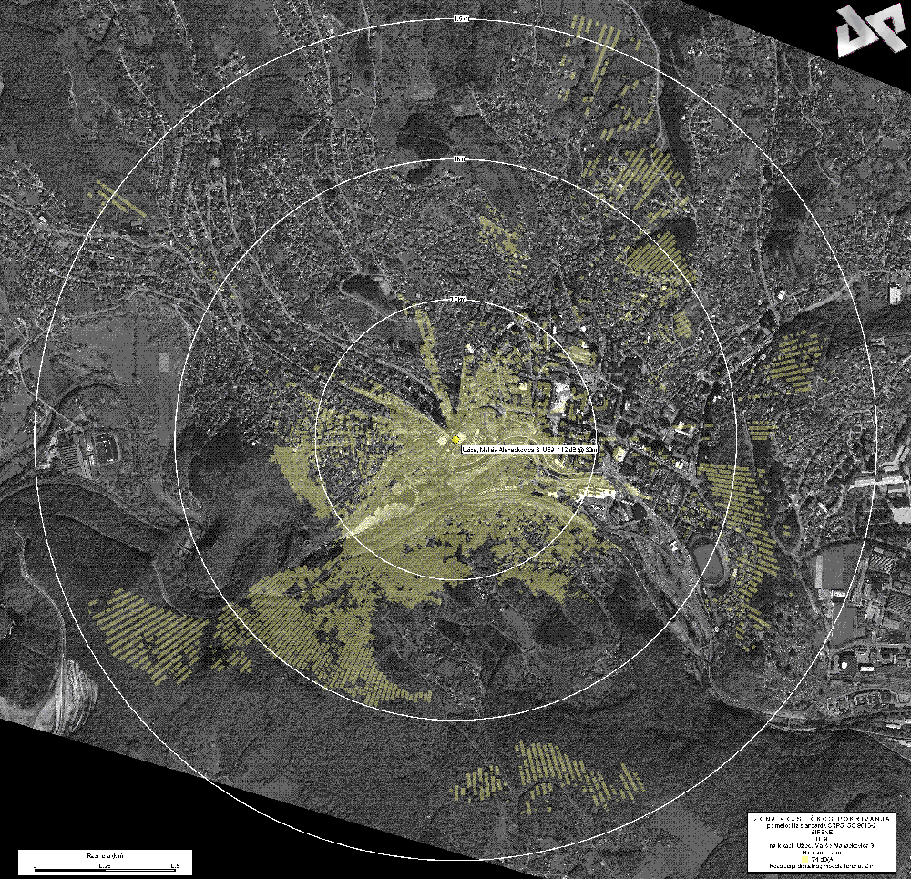
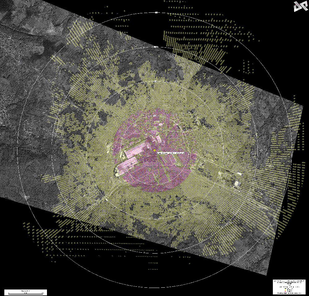
This software has been developed for company needs related to the efficient provision of quality calculations required for preparation of technical documentation e.g. calculations of electrical field strength on certain distance from transmitter, graphical and calculation tables of coverage area, graphical view of optical visibility area, as well as terrain profile and profile of the level of EMF. The software is regularly being updated with ITU-R recommendations and represents a fully functional and up-to-date ICT solution.

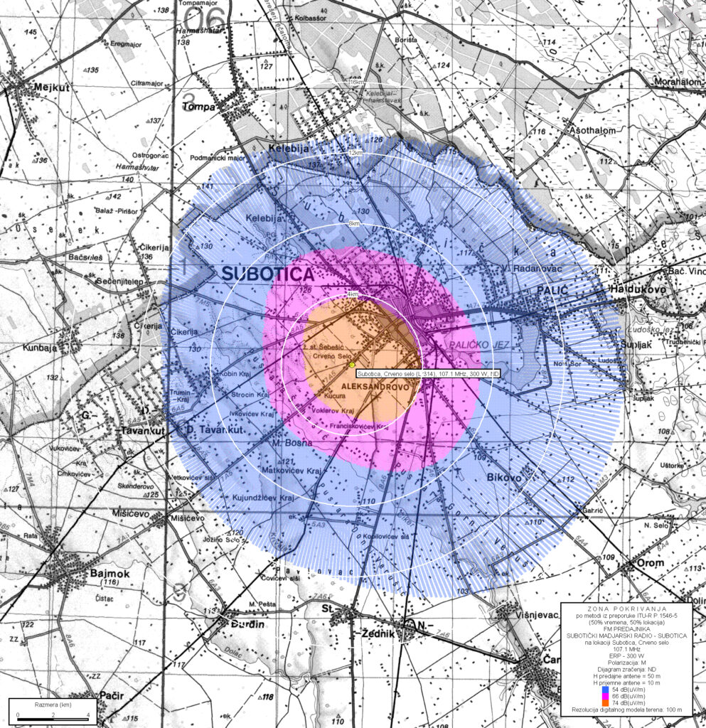
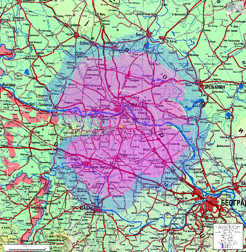
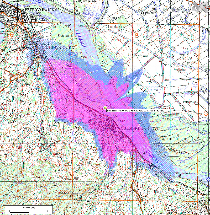
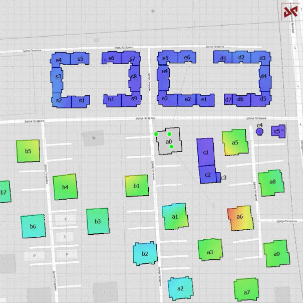
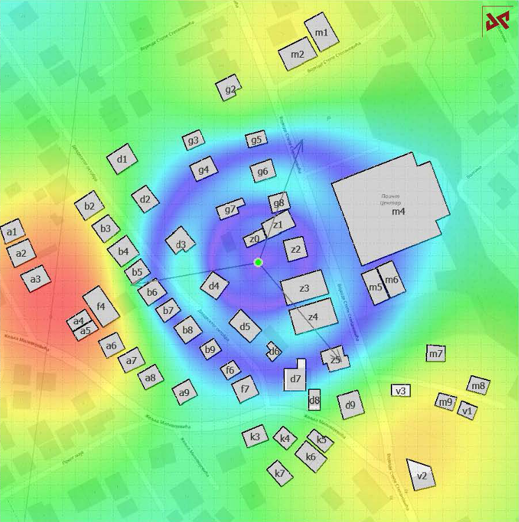
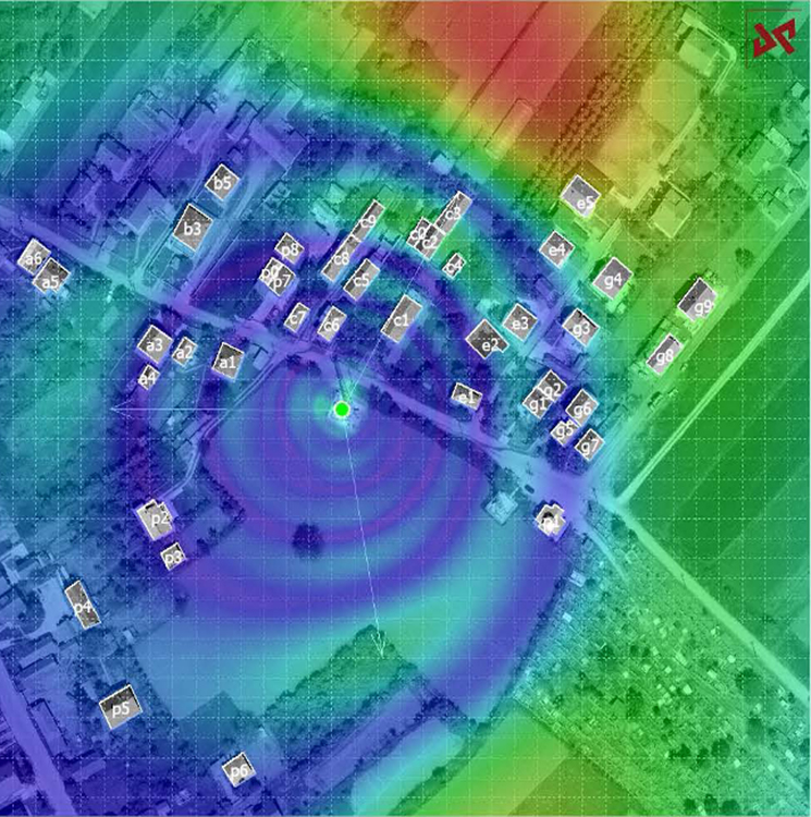
ASTEL SOFTWARE performs several complex functions, which enable different significant calculations, such as: radio - relay links, functional communication systems, radio signal coverage zones, fixed network, mutual influence of new FM/TV transmitter and existing one, coordination zone and budget link of terrestrial satellite stations and electricity levels. fields at ground level and on the floors of surrounding buildings around sources of electromagnetic radiation / radio transmitters.

ASTEL
EMF

ASTEL EMF is an in – house developed software for calculations of electromagnetic field (EMF) within local area of predefined sources on a certain level above the ground. Also, this software enables calculations of the EMF level by floors of predefined objects in the EMF source area. Results are shown graphically and tabular wise. Satellite images, maps of different source scale, aero images (orto photo), even the technical drawings of object grounds can be used as inputs as well as the terrain shape using one of several digital models which are incorporated in the software (2m, 20m, 30m etc.)
ASTEL EMF calculations are most commonly used for conformity assessments of future new or modified sources of radiation such as base stations with the Regulations which define the level of population exposure of electromagnetic field within the source area.

ASTEL
SOUND

ASTEL SOUND is also a software developed and specially designed by ASTEL PROJEKT for the calculations of acoustic coverage zones at a specific distance from the alarm siren and graphical view of acoustic coverage zone.

The core of the programme is a database of the digital model of the terrain in resolution of 2m, 5m, 20m, 50m and 100m and according to this model also digitalized geographical maps of Serbia with the source scale 1:1 000 000, 1 : 600 000, 1 : 500 000, 1 : 300 000,  1 : 200 000, 1 : 50 000 i 1 : 25 000.

This software enables calculations of acoustic coverage zone at a specific distance from the alarm siren in alignment to Recommendation SRPS ISO 9613-2 including different parameters: geometric divergence, atmosphere absorption, impact of the land’s surface and obstacles. Furthermore, the programme offers the possibility of the correction of different values, depending on the urbanization degree and graphical view of the acoustic coverage zone for different marginal levels of acoustic pressure, along with drawing of the terrain profile with 1 degree step.